8 days into repairing the recovered Quasar....the brake and derailleur cables and most of the drive chain are unfrozen from very thick, heavily encrusted rust. This temporary seat post is too short but so was the last one that didn't get returned with the stolen, now recovered, bike. The new-to-me used seat given to me in empathy by Atwood at McCully Bike Shop reminds me of the one still stolen. The severed security cable that the thief showed me is no longer acceptable for proper bicycle security....has been replaced with 2 very expensive "OnGuard" brand, half inch thick "ultra hardened steel shackles", model #s 5009 BULLDOG LS and 5010 BULLDOG STD that the salesman seemed to think will improve my chances to keep the bike from theft in the future....we'll see, I guess.
But now, it's time for the first long ride to see what else needs attention in the recovery effort....
Hey...how 'bout ridin' Ka'ena Point?
What good is a mountain bike if you don't take it off-road once in a while?
Day 7 of last year's walk was the most memorable day of the 10 for me as I got a chance to return to what many years ago was one of my favorite past times when ever I had a few days to a week or so to waste away strapped to a back pack for hiking and camping excursions.
Bus schedules showed the proper choices to make, I bottled up 4 liters of water, and quickly assembled what I thought would get me through what might be an hour or so on each bus ride coming and going...and maybe 4 hours or so on...or in...the saddle...or perhaps walking.
Ka`ena Point access and perimiter trails can take an old man off his pedals here and there when the rocks, bumps, and holes....and possible vertical drops....make one think riding isn't everything.
So...off I go!
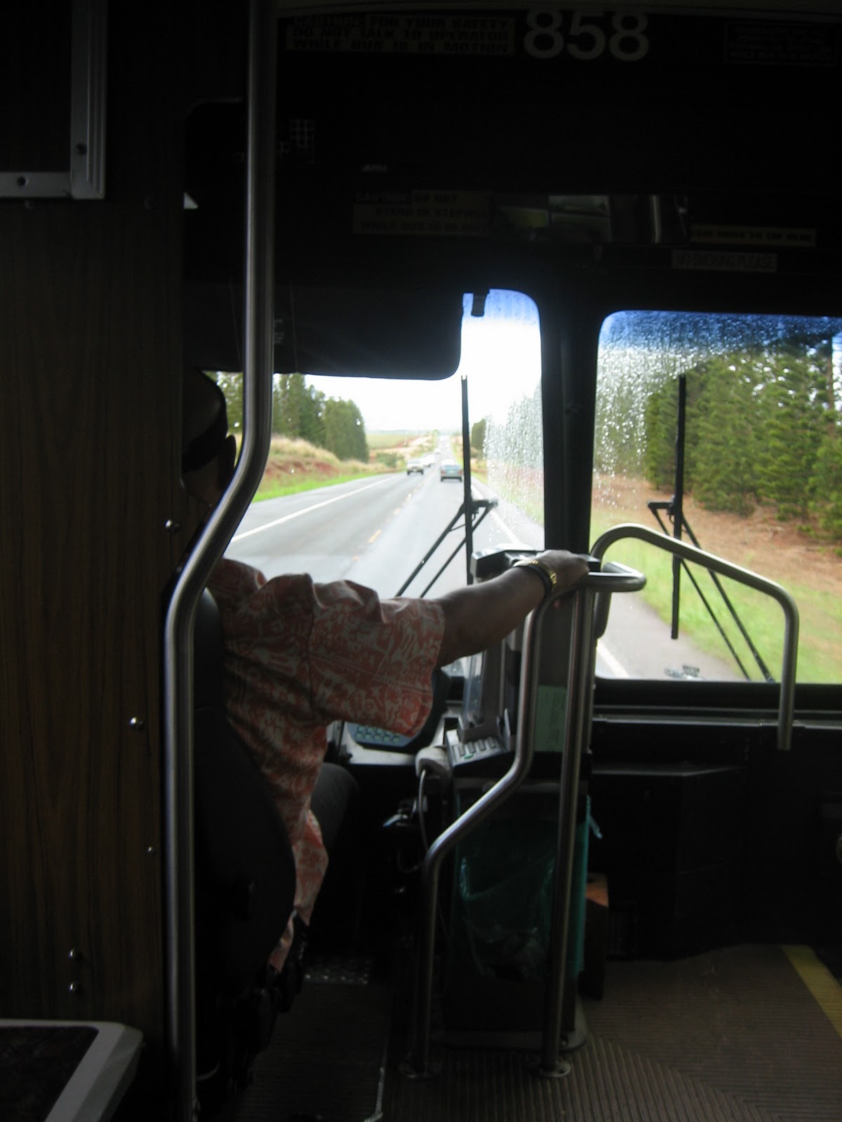
 I trundle down to the Punchbowl and Beretania Street's bus stop seen here where you see this #1. This should be the closest stop to flag a #52 circle-island, Hale`iwa bound unit that the next one should be showing up about 7:46am....if it's not late.
My #52 pulled up about 10 minutes later....only about 3 minutes late!
Life is good!


Raindrops were on the windows all the way to Hale`iwa and I hadn't thought of packing the disposable rain top I'd gotten from the Walk the Talk staff last year and never threw out......and was beginning to wonder if not bringing it today might prove to be a problem...?
Both coming and going, the bus ride in and out of the city to Hale`iwa and from the far end of Makaha was almost an hour and a half both ways. Lotta stops in Wahiawa/Mililani going north and after the complete Waianae coast, Kapolei was also packed in before all the stops on Dillingham Blvd back through Kallihi.

I got out the far end of Hale`iwa at the Beach Park where I could "freshen up" at the lua...but also while there, caught these 4 paddle boarders, 1 ocean going kayak,.....and a harbor marker buoy.


It's about 10am on a Saturday morning in late October...
...and Hale`iwa looks deserted.
I started into town and had to make my first stop to picture this famous bridge that you don't have to be an O`ahu resident...or even a Hawaiian resident to recognize if you remember the 1987 movie, "North Shore" filmed on this north shore with Nia Peeples in her breakout role and a whole bunch of locals including surfers Gerry Lopez playing a role but also as extras, Shaun Tomson, Hans Hedemann, Derek Ho, Mark Foo, Ken Bradshaw, Mike Latonic and many others....memories.


Joe's was a Chart House 'bout a decade ago or so.


Now we got some bridge traffic...
...'n a few people at Matsumoto's too.
Utu splurge on us here last year and we all got a cone of the famous Matsumoto's Shave Ice.
What a treat!

We spent the night here at the end of Day 6 last year...

...right across the road from the sky diver businesses.
I grabbed the camera as one was coming in...but by the time I got it focused, he/she was on the ground.
You can see the chute on either side of but behind the middle phone pole.
You can see the chute on either side of but behind the middle phone pole.

A panorama of Waianae Ridge from Mokule`ia
This is what you end up with when you see a panorama that inspires you...and all you have to shoot the 4 side-by-side shots with is a 5 Mega Pixel Canon Elf.
 The north and west shores of O`ahu as you've never seen them.
Ka`ena Point as seen from relatively low altitude,apparently shot
from one of the aircraft this business flies off this end of Dillingham Air Field...
...a photo posted on the wall in the sun shelter
where tourists gather to await their turn to ride in a glider.
This is the last stop at a business on the north shore as I approach the trail head...one of the 3 glider/plane businesses on the west end of Dillingham Air Field. I first walked....or would you believe rode my then bike up from Makakilo into here in the Fall of 1975 at the very beginning of my 35 years living in Hawai`i. In a couple of consecutive weeks, I logged my first...and last...hour and a half of glider pilot training. The first job I got hired at in Hawai`i immediately sent me to Maui where I lived the next 20 years...effectively ending my glider pilot training.
While that appears to be a fishing pole stuck in the beach sand on the right......I'm expecting very little meeting of humanity for the next several hours as I now begin to move down the last mile of pavement...

...to where the Ka`ena Point State Park perimeter trail begins...
...right there it is--->
...and here is the beginning of the trail.

I was able to peddle this first rise...that is accompanied by phone/power lines that feed up the rise to the state park that runs along the top of the Waianae Ridge

Here, the power lines continue adjacent to the 4-wheel drive trail while the surface is still relatively tolerable for an old biker

The better part of a half mile later, I face back down the coast to take this one to show that I just passed about 2 dozen Kamehameha School Intermediate School kids on an in-and-out day hike.
So much for missing the 'meeting of humanity.'
This is also where the power lines stop following the perimeter trail and head up the slope to the ridge in the state park.

Most graveyards I've seen show efforts to remember their predecessors with sentiment rather than "keep out" signs

This still looks pretty smooth but the rocks, bumps, and divots seem more profound this year and I spent at least half my time walking the bike as I made the final approach to the bird sanctuary.
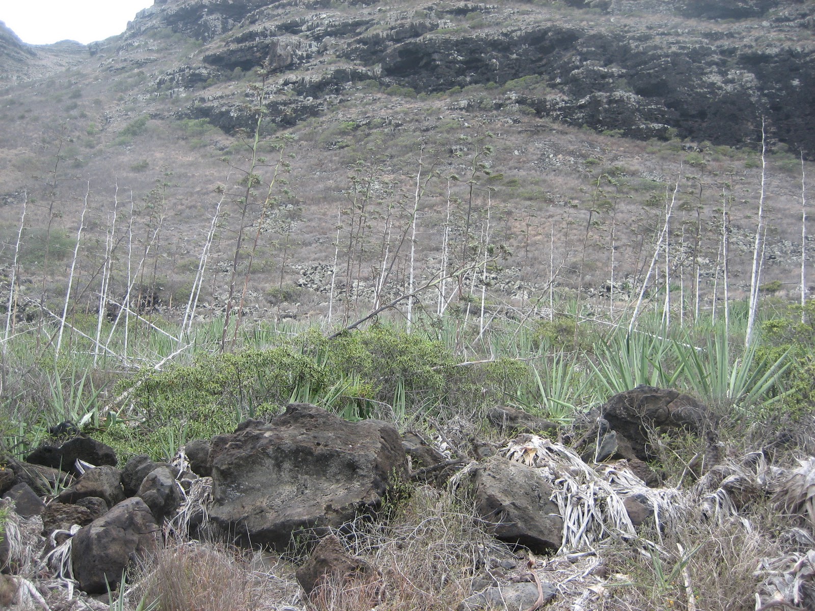
The statewide ambient dry weather we've been plagued with for at least a year or so now has a lot of the remote growth looking very gray.
This apparent 'agency(?) managed' effort that I can neither verify nor describe at least has a thickened green base to accompany it's very lean trunk stems that rise about 20 feet or so.

Finally! The entrance to the Bird Sanctuary
This is where the automotive vehicle presence ends as I poke my bike and body through the square hole.
That blue sign you see to the right of the entrance puka...

...obviously speaks to sanctuary violations here
and on Kauai in the recent past.
While I didn't see any today...,
these are shots of a shearwater and an albatross...

<--- I saw this shearwater...

...and this albatross...--->
...on last years trek through the sanctuary.
I saw a handful of stilts scurrying on the trail as I approached the sanctuary on this recon run......but they were too quick for me. By the time the camera was in front of my face, they were gone. I'll be shocked if I don't see any shears or albatross'es on the walk this year when I'll be taking more time to see the "sights."

The sign above tells of the trail restrictions inside the sanctuary.
The iron posts holding the lines on either side of the trail during the passage through the entire bird sanctuary tell you to...
The iron posts holding the lines on either side of the trail during the passage through the entire bird sanctuary tell you to...
...stay on the trail on behalf of the birds.


 Still just inside the sanctuary, we're really close to the shore break now. It's been a really strong trade wind blowing today with intermittent whipping drizzle. I'm hoping the ridge will protect me from it as I run down the west coast after the turn at the Point.
But I gotta show you what it felt like being there with this 1 minute video....
(...unable to load video...)

Hey....who did 'dis....?

I pulled up at the base of the Point on the west side...the beginning of the southern leg...and propped my steed against the sign that tells of the non-avian specie that also frequents the coast of this sanctuary....the Hawaiian Monk Seal...and then climbed the soft sand to the last elevation before the Point disappears into the ocean...


...where the last vestige of what ocean navigators used to call a "Light House," that till this day, ships at sea still sight/track to make sure they are in the right place as they pass by this intersection of ocean currents...and island channel passages.
From this elevation...looking off into the northwest...past the tour guide sign...shows where the Point disappears into the ocean...

...while turning 180° to the southeast, the beginning of the north end of the Waianae Range begins it's climb to then drop to the top of Makakilo/Kapolei on the south end.

Taking a gander slightly to the right of that, you can see my bike still propped against the Monk Seal sign awaiting my return to begin the southern leg...
...but then a zoom in reveals....

I'm still packing lots of energy and have only consumed about half the 4 liters of water I packed for this run...but the presumed time commitment needed to accomplish today's task has been increased by about 50%....that will test my remaining energy.
I need to press on.

About 30-40 minutes later, I come out from behind this sign marking the southern entrance to the sanctuary from the west side.
From now on, one need not worry about wandering off the trail in violation of the laws made to protect the birds inside the sanctuary.
***---***
As I continue to publish this almost 2 days after the effort, I now begin to realize that I should have taken a few more approach pix to show this gulch crossing that is probably the most dangerous moment of the 10-day walk.
Dead Man's Gulch!
Dead Man's Gulch is my nomenclature to stress the possible risks to avoid here. This is where Utu guards and ensures that everyone get's past safely.
After he hand delivered me...and my bike....last year, and continued to ensure that everyone else also safely passed here, I wandered up slope about 20-30 feet on both sides of this deteriorating collapse and discovered a much safer passage.
There is still risk up above but it is much less than keeping on the main trail that requires walking that plank and climbing over big rocks to pass here. I could not have safely passed here by myself with my bike...but did up above today having to lay the bike down twice, scrambling around it, and then picking it up on the other side of the scramble.
As I said above, I wish I'd taken a couple/3 more pix showing how to approach this upper level on the mauka side of the trail just north of this gulch...
...but where you see the big rock on the trail about 20 yards before this gulch, you will also see 2-3 areas on both sides of that rock where you can scramble up a body length or 2 and then see the narrow trail that will take you above the more dangerous passage where the 4"x8" plank about 10 feet long is.


<--That's the plank and is what I saw to my lower right while taking these 3 pix.

This is what I saw to my lower left and is where I went after I got over the bike and then picked it up to move back to the main trail.

I layed the bike down the 2nd time just before getting back down on to the main trail here. The passage was successful....and safely accomplished.

This the 1st of 2 trail narrowings beyond DMG where collapse is threatening.
I'm starting to really tire now and am eager to get it over with for what would be an hour and a half bus ride back to downtown....so....only a few more pix now.


After he hand delivered me...and my bike....last year, and continued to ensure that everyone else also safely passed here, I wandered up slope about 20-30 feet on both sides of this deteriorating collapse and discovered a much safer passage.
There is still risk up above but it is much less than keeping on the main trail that requires walking that plank and climbing over big rocks to pass here. I could not have safely passed here by myself with my bike...but did up above today having to lay the bike down twice, scrambling around it, and then picking it up on the other side of the scramble.
As I said above, I wish I'd taken a couple/3 more pix showing how to approach this upper level on the mauka side of the trail just north of this gulch...
...but where you see the big rock on the trail about 20 yards before this gulch, you will also see 2-3 areas on both sides of that rock where you can scramble up a body length or 2 and then see the narrow trail that will take you above the more dangerous passage where the 4"x8" plank about 10 feet long is.
***---***

This is where I layed the bike down the 1st of 2 times after I had passed beyond the center of the gulch...but still above the trail by maybe 12-15 feet.
This is what I saw to my upper right
and is where I approached from-->

<--That's the plank and is what I saw to my lower right while taking these 3 pix.

This is what I saw to my lower left and is where I went after I got over the bike and then picked it up to move back to the main trail.

I layed the bike down the 2nd time just before getting back down on to the main trail here. The passage was successful....and safely accomplished.
***---***

This the 1st of 2 trail narrowings beyond DMG where collapse is threatening.
The 2nd one is worse than this one but......I didn't take any pix there.
Neither of them is as threatening as DMG.
I'm starting to really tire now and am eager to get it over with for what would be an hour and a half bus ride back to downtown....so....only a few more pix now.

Yokohama Bay Beach Park looking straight off the guard stand...
...south to Makaha............................................................................and north toward the Point.
...south to Makaha............................................................................and north toward the Point.


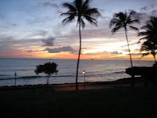
This is the 67 second sunset I recorded there at the end of Day 7 last year...

Now....where's that bus....?
(...closing comments to follow later...
...other things to do now.)


